UPDATED: The National Weather Service has extended the Tornado Watch for Collin, Kaufman, Rockwall, Denton, Wise and Dallas Counties until midnight.
UPDATED: The National Weather Service has issued a Tornado Watch for Johnson, Tarrant, Ellis, Somervell, Hill, Dallas, Parker, Hood, Bosque, Wise, and Denton counties until 9:45 pm
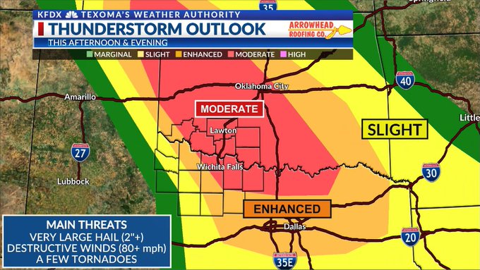
(WBAP/KLIF) — National Weather Service – FT. WORTH — Hot and humid conditions will continue today and produce extreme instability across the area. In addition, strong winds and lift aloft from an approaching upper disturbance late today will help focus storms off a dryline near the western edge of the area, as well as a weak stationary front.

Isolated to scattered storms will develop along and near the boundary after 4 pm with most storms becoming quickly severe with very large hail, damaging winds to 70 mph, and perhaps an isolated tornado or two.
In addition to the severe threat, hot afternoon temperatures between the lower 90s northeast to the lower 100s southwest will combine with oppressive humidity to produce heat index values between 106 and 112 from the DFW area, south and east.
(Copyright 2023 WBAP/KLIF Newsroom News. All rights reserved.)


