


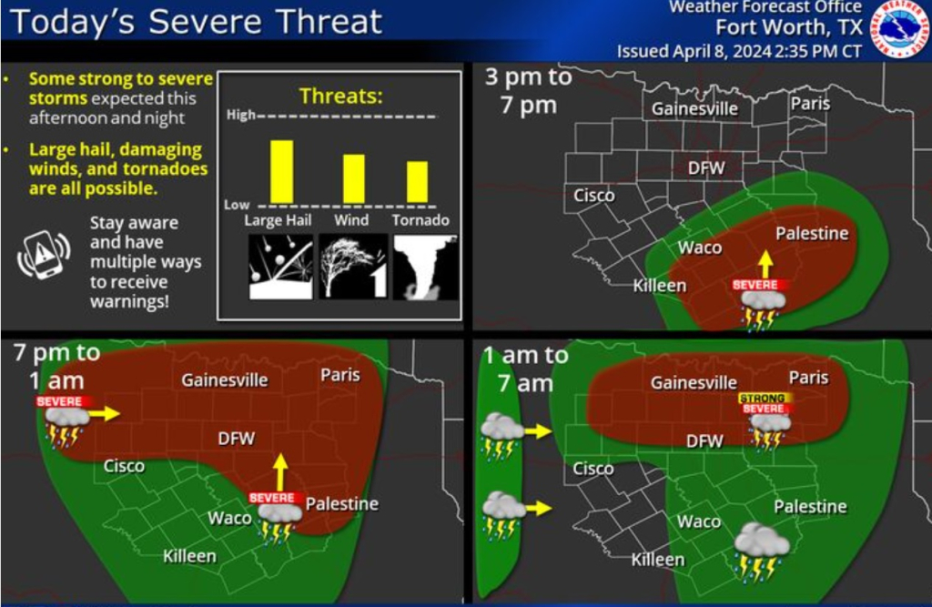
(WBAP/KLIF) – Short-range model shows heavy storms over DFW by 9-10 PM and two storm areas merging over DFW between 6 and 9 AM tomorrow with the potential for high winds including tornadoes, large hail and repeated 3″ per hour rains with flash flooding likely.
Tornado watch southeast of DFW in effect until 8PM. Storms moving north should reach DFW by 8PM or no later than 10PM. Severe Thunderstorm watch just issued west of DFW until 11. Those storms may not move in until after midnight.