


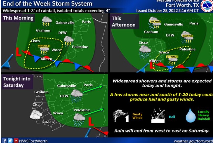
Widespread rainfall amounts of 1 to 3 inches are expected with isolated totals exceeding 4″. Stronger storms capable of marginally severe hail and gusty winds are possible during the daytime, mainly south of I-20.
Friday
A chance of showers and thunderstorms, then showers and possibly a thunderstorm after 7am. Temperature falling to around 55 by 3pm. Northeast wind 5 to 15 mph, with gusts as high as 30 mph. Chance of precipitation is 100%. New rainfall amounts between 1 and 2 inches possible.
Friday Night
Rain and possibly a thunderstorm. Low around 54. North wind 10 to 15 mph, with gusts as high as 25 mph. Chance of precipitation is 100%. New precipitation amounts between three quarters and one inch possible.
Saturday
Rain likely, mainly before 7am. Cloudy, with a high near 61. North northwest wind around 10 mph, with gusts as high as 25 mph. Chance of precipitation is 60%.
Saturday Night
Mostly cloudy, with a low around 53. Northwest wind 5 to 10 mph.
Sunday
Mostly sunny, with a high near 70. North northwest wind 5 to 10 mph.
Sunday Night
Partly cloudy, with a low around 51. West northwest wind around 5 mph.
Monday
Mostly sunny, with a high near 73. Northwest wind around 5 mph.